Photogrammetry
Using Photogrammetry, we can provide Orthomosaic 2d maps and 3d models for farm and property mapping, construction progress, stockpile volume calculations, and measurements.
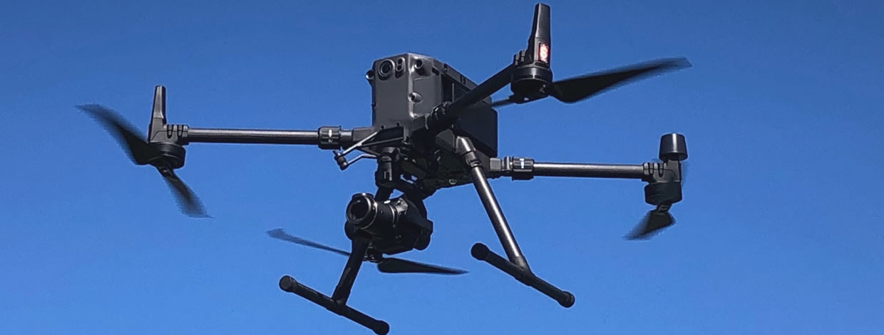
Again, we use the Matrice 300 RTK. With a 45-megapixel, full frame camera attached, and connected to one of our base stations, we can provide cm precision in our results. Deliverables are shared easily with our clients using our processing software in almost any file format required.
Orthomosaic Mapping is a high-resolution, georeferenced aerial imaging technology that can provide a clear and accurate representation of a surveyed area. By using advanced drone technology and specialized software, our Orthomosaic Mapping Services can provide a seamless and accurate map of your survey area, helping you to make more informed and data-driven decisions.
How Does Orthomosaic Mapping Work?
The images are then processed through specialized software that stitches them together to create a single, seamless image. This process, known as photogrammetry, involves using the overlapping images to create a 3D model of the surveyed area, which is then transformed into a 2D Orthomosaic map.
The resulting Orthomosaic map is highly accurate and detailed, with features such as buildings, trees, and other objects appearing in their true location and orientation. This is because the Orthomosaic map corrects for perspective distortions caused by the drone’s altitude, angle of view, and other factors, resulting in a map that accurately represents the surveyed area.
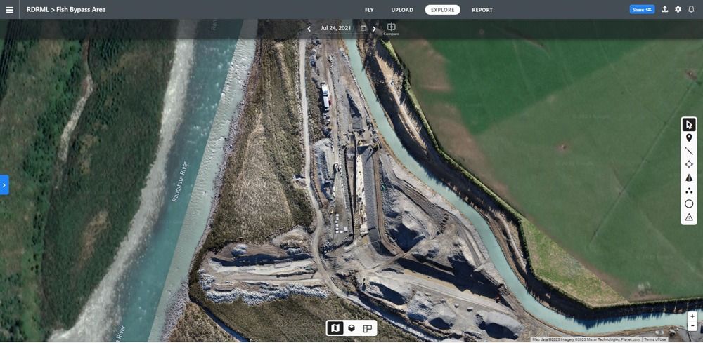
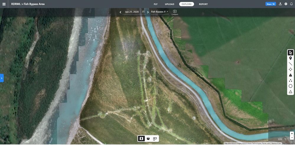
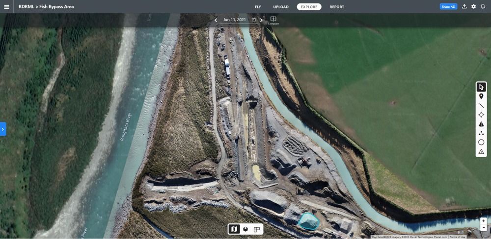
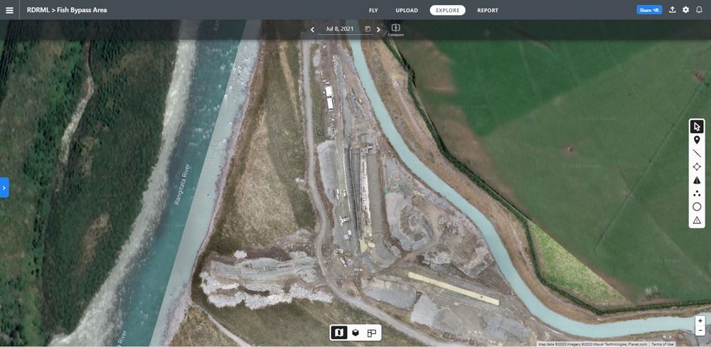
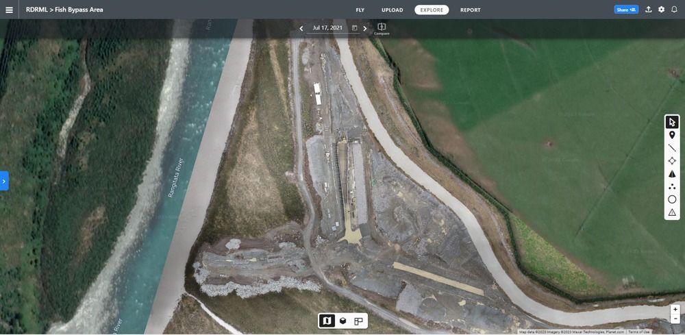
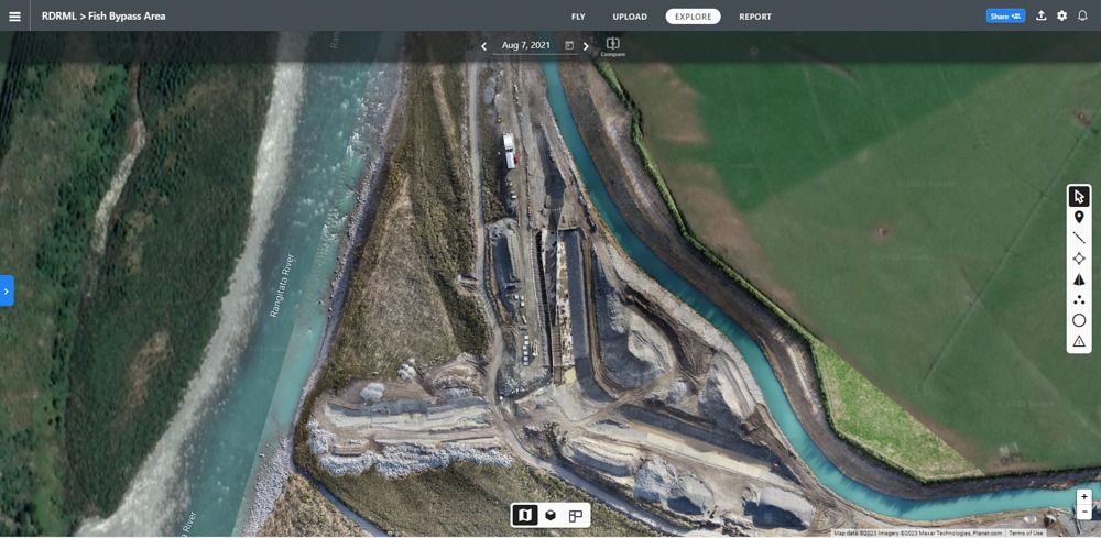
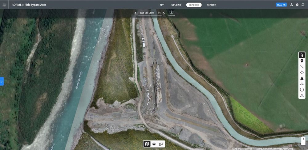
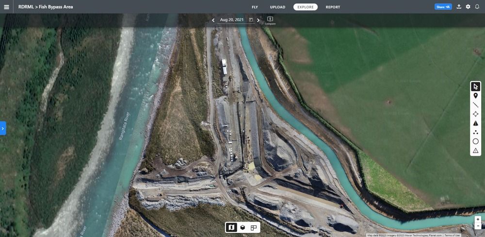
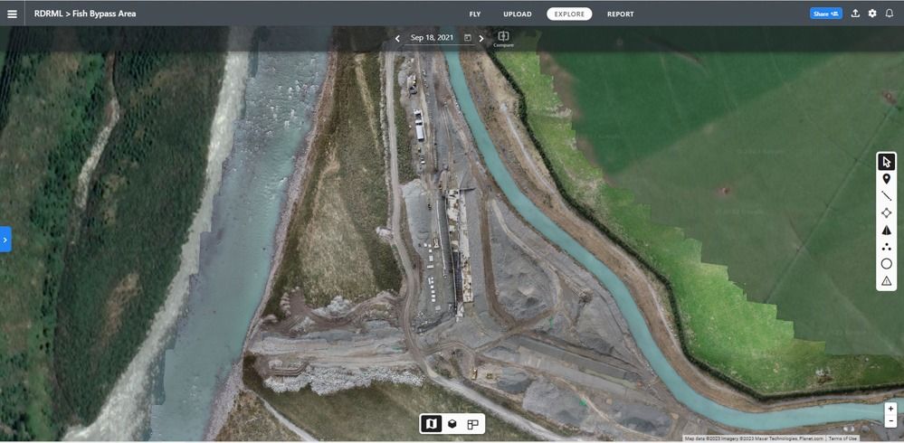
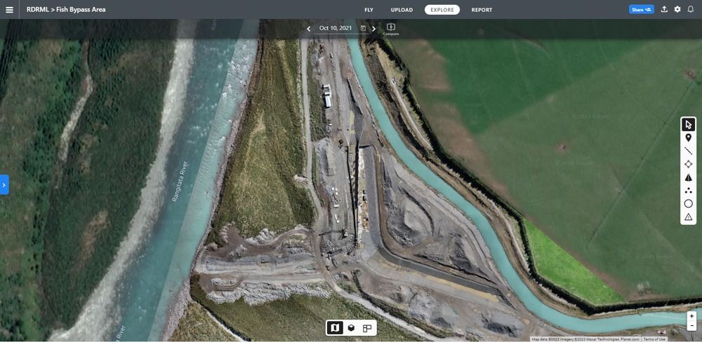
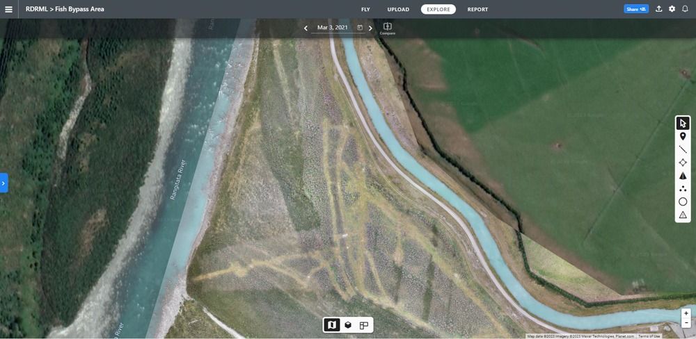
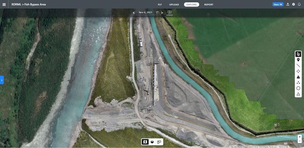
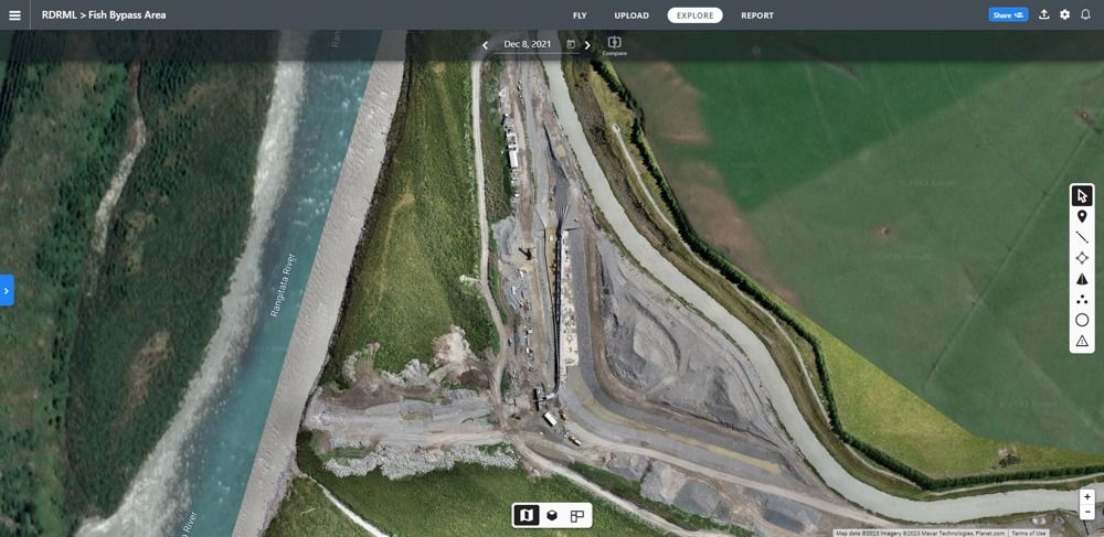
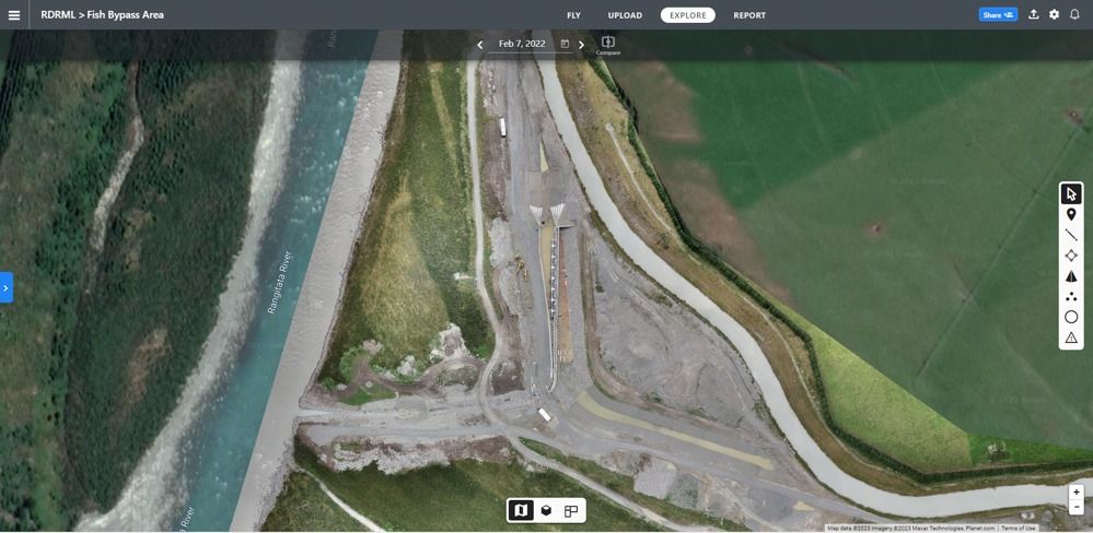
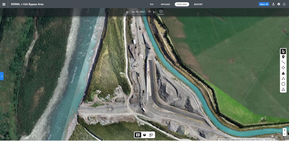
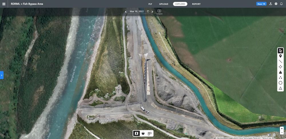
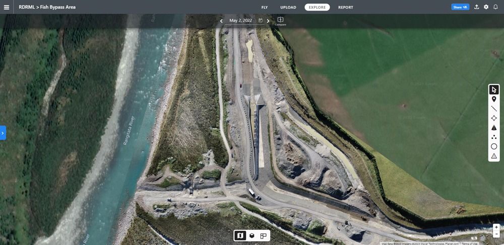
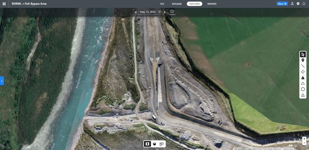
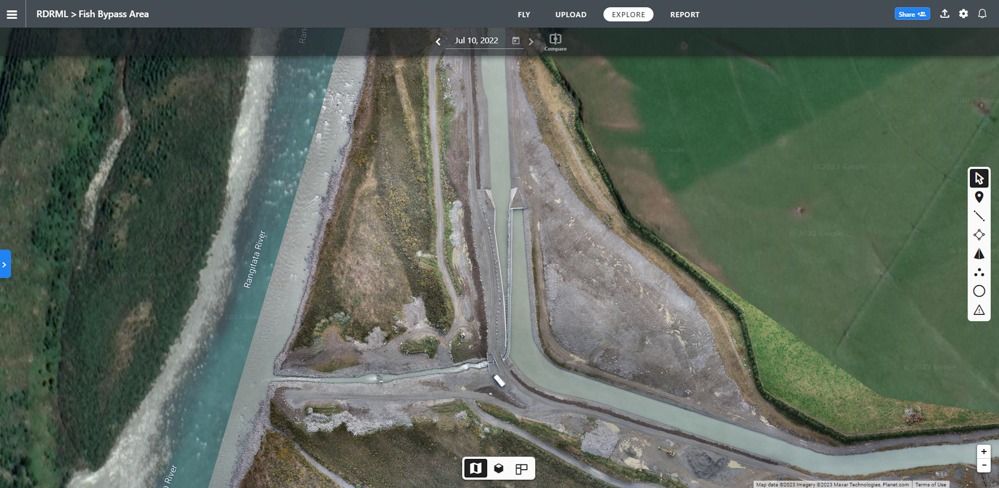
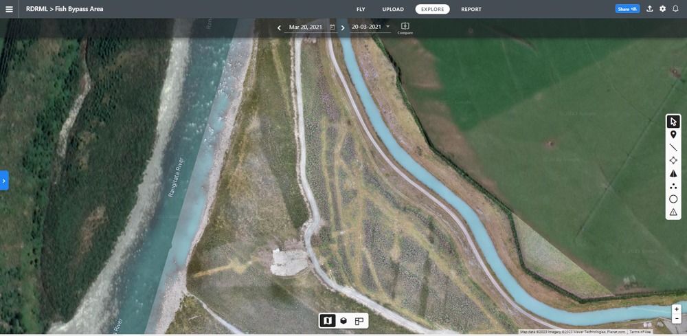
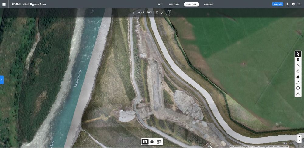
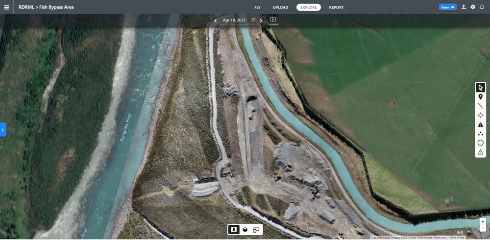
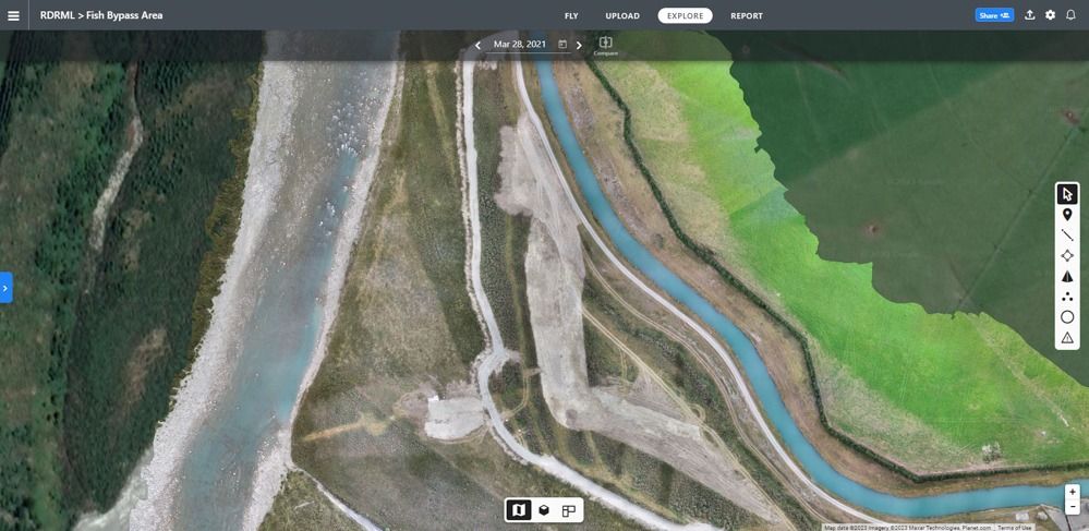
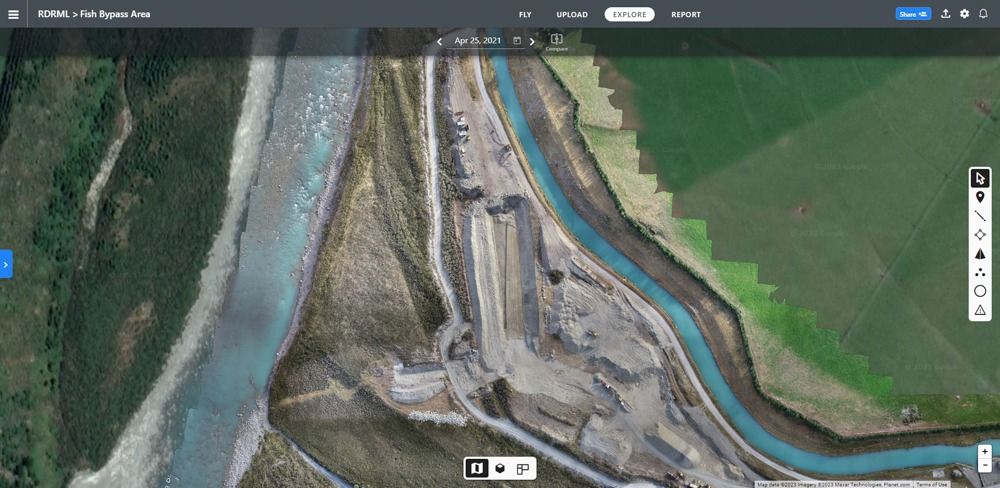
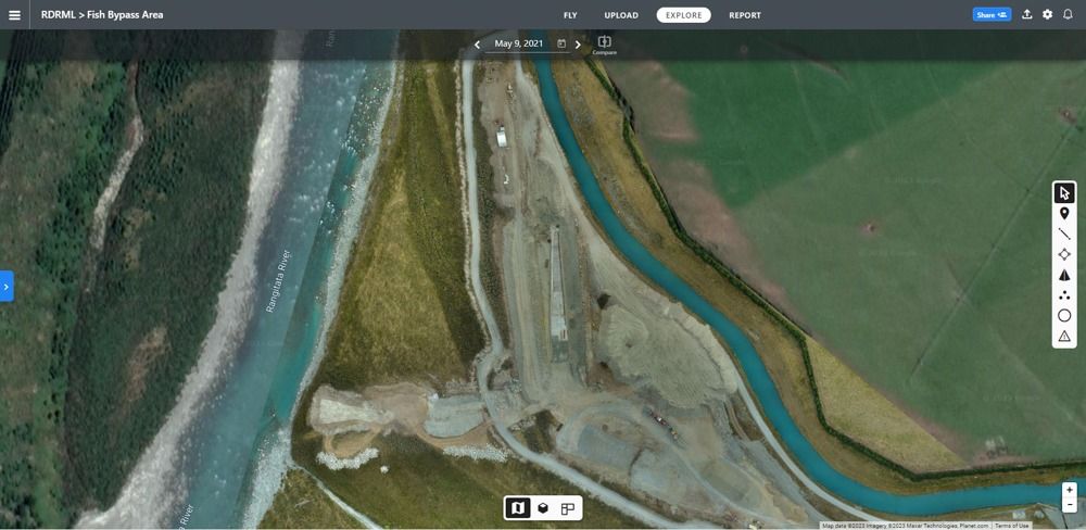
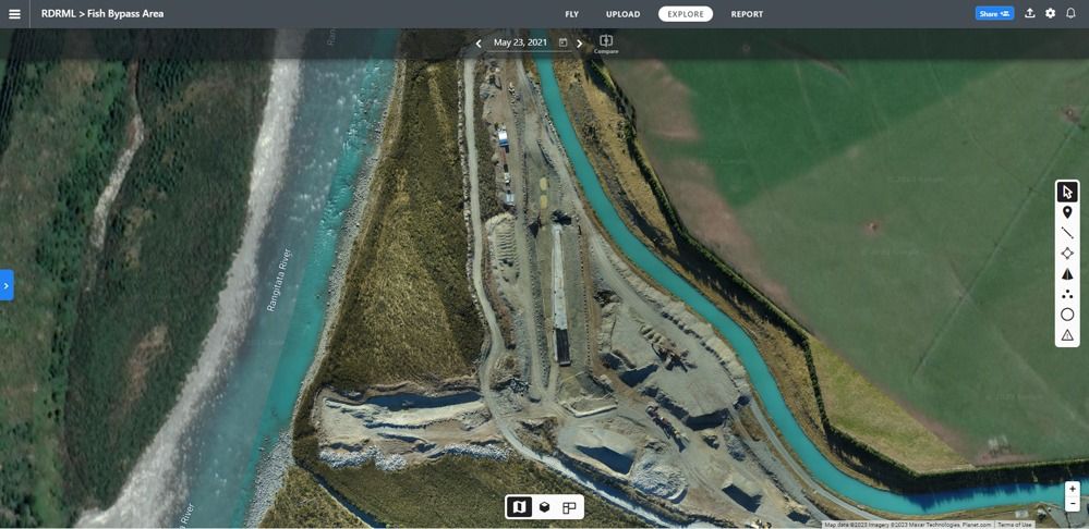
RDRML Fish Screen Construction Progress
Deprecated: str_replace(): Passing null to parameter #3 ($subject) of type array|string is deprecated in /home/agsmart/public_html/components/com_igallery/tmpl/category/default_main.php on line 208

Deprecated: str_replace(): Passing null to parameter #3 ($subject) of type array|string is deprecated in /home/agsmart/public_html/components/com_igallery/tmpl/category/default_main.php on line 208

Deprecated: str_replace(): Passing null to parameter #3 ($subject) of type array|string is deprecated in /home/agsmart/public_html/components/com_igallery/tmpl/category/default_main.php on line 208

Deprecated: str_replace(): Passing null to parameter #3 ($subject) of type array|string is deprecated in /home/agsmart/public_html/components/com_igallery/tmpl/category/default_main.php on line 208

Deprecated: str_replace(): Passing null to parameter #3 ($subject) of type array|string is deprecated in /home/agsmart/public_html/components/com_igallery/tmpl/category/default_main.php on line 208

Deprecated: str_replace(): Passing null to parameter #3 ($subject) of type array|string is deprecated in /home/agsmart/public_html/components/com_igallery/tmpl/category/default_main.php on line 208

Deprecated: str_replace(): Passing null to parameter #3 ($subject) of type array|string is deprecated in /home/agsmart/public_html/components/com_igallery/tmpl/category/default_main.php on line 208

Deprecated: str_replace(): Passing null to parameter #3 ($subject) of type array|string is deprecated in /home/agsmart/public_html/components/com_igallery/tmpl/category/default_main.php on line 208

Deprecated: str_replace(): Passing null to parameter #3 ($subject) of type array|string is deprecated in /home/agsmart/public_html/components/com_igallery/tmpl/category/default_main.php on line 208

Deprecated: str_replace(): Passing null to parameter #3 ($subject) of type array|string is deprecated in /home/agsmart/public_html/components/com_igallery/tmpl/category/default_main.php on line 208

Deprecated: str_replace(): Passing null to parameter #3 ($subject) of type array|string is deprecated in /home/agsmart/public_html/components/com_igallery/tmpl/category/default_main.php on line 208

Deprecated: str_replace(): Passing null to parameter #3 ($subject) of type array|string is deprecated in /home/agsmart/public_html/components/com_igallery/tmpl/category/default_main.php on line 208

Deprecated: str_replace(): Passing null to parameter #3 ($subject) of type array|string is deprecated in /home/agsmart/public_html/components/com_igallery/tmpl/category/default_main.php on line 208

Deprecated: str_replace(): Passing null to parameter #3 ($subject) of type array|string is deprecated in /home/agsmart/public_html/components/com_igallery/tmpl/category/default_main.php on line 208

Deprecated: str_replace(): Passing null to parameter #3 ($subject) of type array|string is deprecated in /home/agsmart/public_html/components/com_igallery/tmpl/category/default_main.php on line 208

Deprecated: str_replace(): Passing null to parameter #3 ($subject) of type array|string is deprecated in /home/agsmart/public_html/components/com_igallery/tmpl/category/default_main.php on line 208

Deprecated: str_replace(): Passing null to parameter #3 ($subject) of type array|string is deprecated in /home/agsmart/public_html/components/com_igallery/tmpl/category/default_main.php on line 208

Deprecated: str_replace(): Passing null to parameter #3 ($subject) of type array|string is deprecated in /home/agsmart/public_html/components/com_igallery/tmpl/category/default_main.php on line 208

Deprecated: str_replace(): Passing null to parameter #3 ($subject) of type array|string is deprecated in /home/agsmart/public_html/components/com_igallery/tmpl/category/default_main.php on line 208

Deprecated: str_replace(): Passing null to parameter #3 ($subject) of type array|string is deprecated in /home/agsmart/public_html/components/com_igallery/tmpl/category/default_main.php on line 208

Deprecated: str_replace(): Passing null to parameter #3 ($subject) of type array|string is deprecated in /home/agsmart/public_html/components/com_igallery/tmpl/category/default_main.php on line 208

Deprecated: str_replace(): Passing null to parameter #3 ($subject) of type array|string is deprecated in /home/agsmart/public_html/components/com_igallery/tmpl/category/default_main.php on line 208

Deprecated: str_replace(): Passing null to parameter #3 ($subject) of type array|string is deprecated in /home/agsmart/public_html/components/com_igallery/tmpl/category/default_main.php on line 208

Deprecated: str_replace(): Passing null to parameter #3 ($subject) of type array|string is deprecated in /home/agsmart/public_html/components/com_igallery/tmpl/category/default_main.php on line 208

Deprecated: str_replace(): Passing null to parameter #3 ($subject) of type array|string is deprecated in /home/agsmart/public_html/components/com_igallery/tmpl/category/default_main.php on line 208

Deprecated: str_replace(): Passing null to parameter #3 ($subject) of type array|string is deprecated in /home/agsmart/public_html/components/com_igallery/tmpl/category/default_main.php on line 208

Deprecated: str_replace(): Passing null to parameter #3 ($subject) of type array|string is deprecated in /home/agsmart/public_html/components/com_igallery/tmpl/category/default_main.php on line 208


Orthomosaic mapping is a valuable tool for a wide range of industries, including GIS, surveying, land development, construction, civil engineering, oil and gas, power lines, and city planning, among others. The technology can be used for environmental monitoring, land management, infrastructure planning, topographic mapping, site monitoring, quality control, natural resource management, and more.
What industries can benefit from Orthomosaics?
- GIS Professionals: Benefits GIS professionals by providing them with highly detailed and accurate maps that can be used for environmental monitoring, land management, and infrastructure planning.
- Surveyors: Provides surveyors with an efficient and accurate way to create topographic maps and assess survey areas, leading to better land development and management.
- Land Developers: Helps land developers with the acquisition and development of land by providing accurate and detailed maps that can help them make informed decisions.
- Construction Firms: Assists construction firms with project planning, site monitoring, and quality control, ensuring that projects are completed efficiently and effectively.
- Civil Engineers: Provides civil engineers with highly detailed and accurate maps of surveyed areas, which can be used for infrastructure planning and design.
- Oil and Gas Companies: Benefits oil and gas companies by providing them with accurate and detailed maps of survey areas, allowing them to better assess and manage natural resources.
- Power Line Maintenance Crews: Helps power line maintenance crews by providing them with accurate and detailed maps of power lines and the surrounding areas, enabling them to plan and execute maintenance operations more effectively.
- City Planners: Assists city planners with infrastructure planning, land-use planning and environmental monitoring, allowing them to make informed and data-driven decisions.

